Holiday travel "difficult to impossible" as blizzard conditions, freezing rain hit the Plains
A major Christmas winter storm that has already brought heavy snowfall and freezing rain to the central U.S. is expected to continue impacting travel, according to forecasts.
Another four to six inches of snow is expected over the western High Plains on Tuesday, the National Weather Service said in an update early Tuesday.
"The combination of either falling snow or snow on the ground with strong winds will lead to areas of blowing snow and near-blizzard conditions this morning," NWS said. "Travel may be difficult to near impossible due to snow-covered roads and whiteout conditions."
The agency also warned about fallen tree branches and power lines.
The large storm system will continue to bring severe winter weather to portions of north-central U.S. through early Wednesday, NWS said in an update Tuesday afternoon.
An additional two to four inches of snow, with local totals of eight inches, are expected across western South Dakota, western Nebraska, far eastern Wyoming, and northeastern Colorado, with some lighter snow into the mid-Missouri Valley, according to NWS.
There is a high probability that areas of south-central South Dakota and north-central Nebraska will get over a foot of total snowfall, the agency said.
The heavy snowfall and wind gusts of upwards of 55 mph will lead to blizzard conditions.
Additionally, portions of northern and eastern South Dakota into southern and eastern North Dakota are dealing with a continuing freezing rain event, according to NWS.
Portions of I-90 were closed Tuesday morning, while roads west of I-29 were either partially or completely snow-covered, NWS Sioux Falls tweeted.
Update 835 AM: I-90 remains closed between Mitchell and Wall. Overall, roads west of I-29, are either partially or completely snow covered. Roads are west east of I-29. Be aware that temperatures will slowly fall through the morning and untreated wet roads may begin to freeze. pic.twitter.com/VYeLnyGNdF
— NWS Sioux Falls (@NWSSiouxFalls) December 26, 2023
In a separate tweet, NWS Sioux Falls said that roads will remain slick due to light precipitation.
"Refreezing wet roads along with light icing will keep roads slippery," NSW said. "Please drive with caution!"
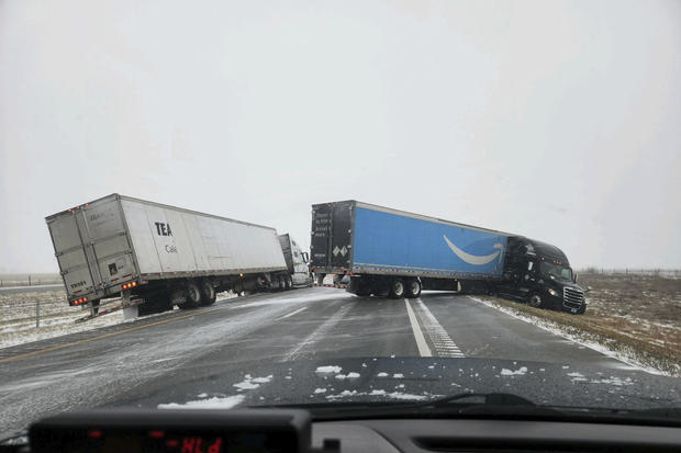
In eastern Colorado, a blizzard warning led to a full closure of Interstate 70 for several hours on Tuesday morning, CBS Colorado reported.
"The Blizzard Warning is south and east of the Denver metro area and includes parts of five states including Colorado, Wyoming, Kansas, Nebraska, and South Dakota through 5 am on Wednesday," according to CBS Colorado.
- In:
- Weather Forecast
- Blizzard
Disclaimer: The copyright of this article belongs to the original author. Reposting this article is solely for the purpose of information dissemination and does not constitute any investment advice. If there is any infringement, please contact us immediately. We will make corrections or deletions as necessary. Thank you.


