See Hurricane Idalia from space: Satellite views from International Space Station show storm off Florida coast
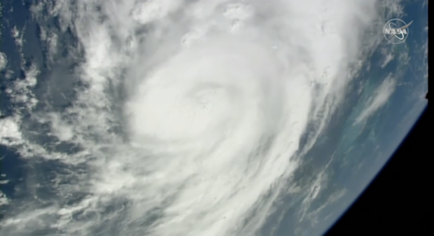
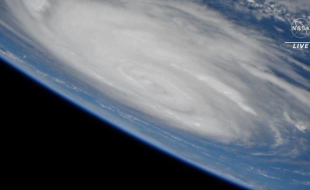
A satellite view from the International Space Station gave viewers a unique look at Hurricane Idalia as the sprawling storm takes aim at Florida.
The space station passed over the storm at 11:25 a.m. ET. The live view showed Idalia, which strengthened into a hurricane early Tuesday, churning over the Gulf of Mexico. In an 11 a.m. advisory, the National Hurricane Center said the center of the storm had sustained winds of 85 miles per hour extending out about 15 miles.
The flyover lasted approximately 15 minutes. You can watch the video below (note the video shot from the space station is silent):
The station also flew over Hurricane Franklin, which is working its way up the East Coast. Franklin was causing "life-threatening surf and rip current" along the U.S. coast, the hurricane center said, but it is not forecast to make landfall and will stay out to sea.
Hurricane Idalia is expected to make landfall on Florida's Gulf Coast on Wednesday. It's expected to be a major, dangerous hurricane, according to the National Hurricane Center, and will impact a wide portion of the state, including Tampa and Orlando. It will cross the state before approaching the Carolina coastline on Thursday, according to forecasters.
Forecasters have warned about a dangerous storm surge, which could cause major flooding. In a news conference, Florida governor Ron DeSantis said some areas may see surges as high as 8 to 12 feet, depending on the tides.
DeSantis declared a state of emergency in 46 counties and the state mobilized 1,100 National Guard members. Evacuation orders or suggestions were posted in 21 counties.
The International Space Station has been in orbit since 1998 and is about 250 miles above Earth's surface. It is a functioning research laboratory where astronauts and experts look at fields like human health, biosciences, engineering research, and Earth and space imaging and observations. Some research projects track hurricanes, cyclones and other weather phenomena from space.
- In:
- Storm
- Weather Forecast
- International Space Station
- Florida
- Space
- Hurricane

Kerry Breen is a news editor and reporter for CBS News. Her reporting focuses on current events, breaking news and substance use.
Disclaimer: The copyright of this article belongs to the original author. Reposting this article is solely for the purpose of information dissemination and does not constitute any investment advice. If there is any infringement, please contact us immediately. We will make corrections or deletions as necessary. Thank you.


